
Contact Us
NO.26 BAIWANZHUANG ROAD,Beijing,100037.China
Tel: 86-10-68999619
86-10-68999623
Fax: 86-10-68310894
E-mail:
cgn@cags.ac.cn
ggn2004@gmail.com
%c_location% Home > Members list
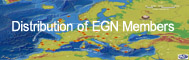
Novohrad-Nograd geopark


Novohrad-Nógrád Geopark is located in Central Europe, in North-Hungary and South-Slovakia. Itcomprises the administrative area of 63 settlements in Hungary (including urban county Salgótarján) and 28 settlements in Slovakia. The Southern part of the Geopark can be reached by car in an hour from the Hungarian capital Budapest.Lucenec is the biggest Slovak city close to the Geopark.
The name of the geopark comes from the Slovak and Hungarian names of the County, where the proposed Geopark is located. The emblem of the Geopark represents the Somoska/Somosko Castle. At the very foot of the castle marked the border line between Slovakia and Hungary after the First World War, separating communities from each other and artificially the landscape for 85 years. The castle stands on a basalt outcrop which represents beautifully the human interaction with the geological past.

The Cave of Mučín was formed by the mouldering of a tree trunk in rhyodacite tuff
The total administrative area of the Geopark is 1. 587 km2 (1. 251 km2 in Hungary and 336 km2 in Slovakia). Novohrad-Nógrád Geopark comprises every settlement of two micro-regions in Hungary (Salgótarján and Szécsény) plus some settlements from the micro-regions of Balassagyarmat, Bátonyterenye, and Pásztó. In Slovakia the geopark incorporates the southern parts of the districts Rimavská Sobota, Lucenec and Velký Krtíš, the settlements of Velických jazerách, Obrucná, Pod Buceňom and Medveš micro-regions.
The area of the Novohrad-Nógrád Geopark is landlocked and dominated by hills, divided by valleys and basins. The area’s varied history is reflected in a unique landscape comprising rolling hills, volcanic plateaus and lowlands overshadowed by volcanic peaks. The peaks provided ideal sites for fortresses during the middle ages and in the hidden valleys isolated communities maintained their special folklore, consequently the human landscape is interwoven on several levels with the geological past.