

Contact Us
NO.26 BAIWANZHUANG ROAD,Beijing,100037.China
Tel: 86-10-68999619
86-10-68999623
Fax: 86-10-68310894
E-mail:
cgn@cags.ac.cn
ggn2004@gmail.com
%c_location% Home > Members list
Rokua Geopark
Rokua is a unique combination of geology, nature and culture on the Northern hemisphere not far away from the Arctic Circle. The characteristic features of the area are the landforms shaped by the Ice Age: glacial ridges, pine and lichen-clad heaths, kettle holes and small ponds filled with crystal clear water.
In addition to the incomparable environment, the area tells the story of a prehistoric settlement of the human being and of theever since flourishing culture.
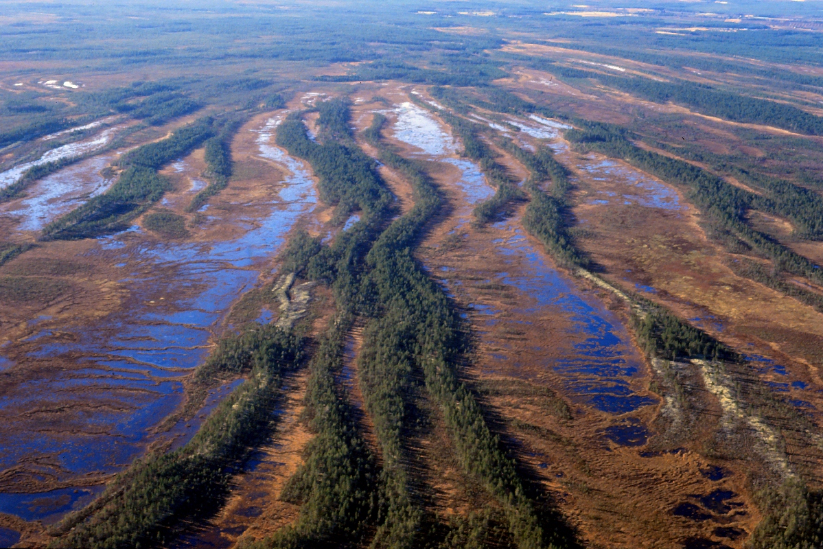
Rokua Geopark consists of the River Oulujoki Valley, Rokua esker and dune area and Lake Oulujärvi areas. The areas are linked by the Rokua esker field and its geosites, which were formed on top of ancient bedrock in the withdrawal phase of the last Ice Age (Weichsel).
The Rokua esker field, which originated from the Muhos Formation located in the River Oulujoki Valley, runs across the area from River Oulujoki valley to Rokua esker and dune area, through Lake Oulujärvi to Manamansalo. In addition to the geology, the areas are also connected by the prehistory of the people who followed the withdrawal of the ice sheet and sea.
Attractions:
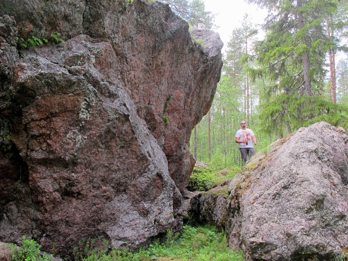
In addition to eskers and dunes, the area’s particular natural forms include deep, clear lakes and kettle holes, of which one is the deepest in Finland. In the area is located the Rokua National Park, which was founded in 1956 to protect the area’s sensitive barren heaths.
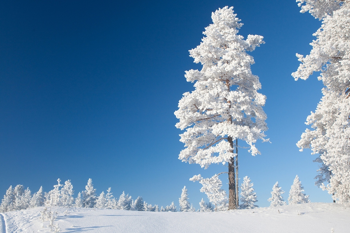
The Rokua forests are low in nutrients and, due to the highly permeable soil, monotonous in terms of its flora. Characteristic of the pine‐dominated landscape are the white, treeless lichen heaths of the sand dunes. The very limited flora of the barren, dry heaths consists mainly of shoots. In winter, the treecovered hills keep the snow longer than the surrounding lower land. Accordingly, the snow covered terrain is also most effective in withstanding human activity.
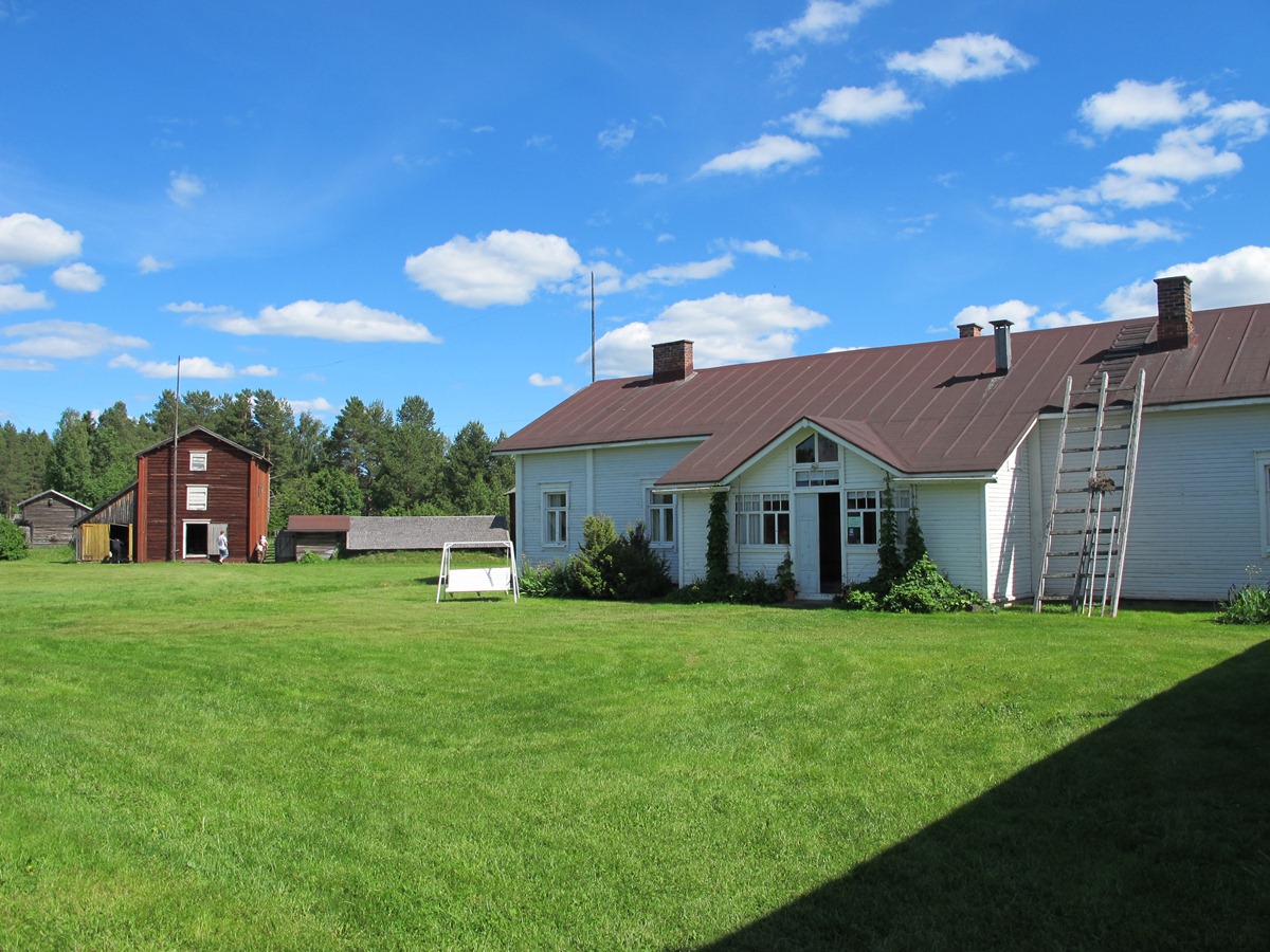
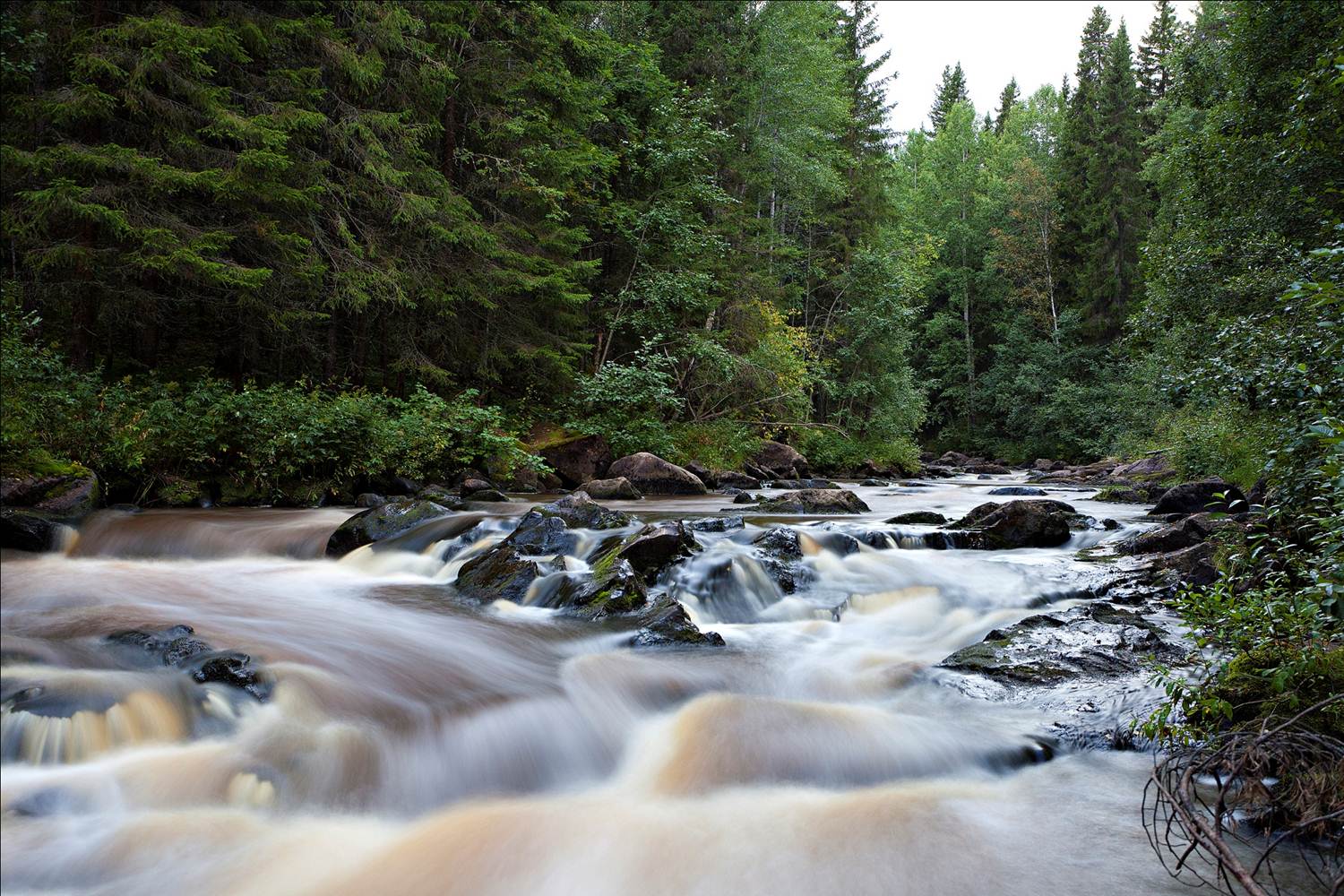
The River Oulujoki Valley is a nationally valuable landscape area. In addition to the river, it is characterised by long‐standing agricultural activity. The River Oulujoki has been harnessed for electricity production; seven hydro‐electric power plants were built on the river in 1940s and 1950s. To the north of the river there are wooded ridge areas, and in the south open hillocks, mounds, forest groves and a field landscape cut by deep stream channels. In the river valley one can find southern, even demanding plants, because it is a transition zone between southern and northern plant species. The River Oulujoki Valley landscape is characterised by agriculture.
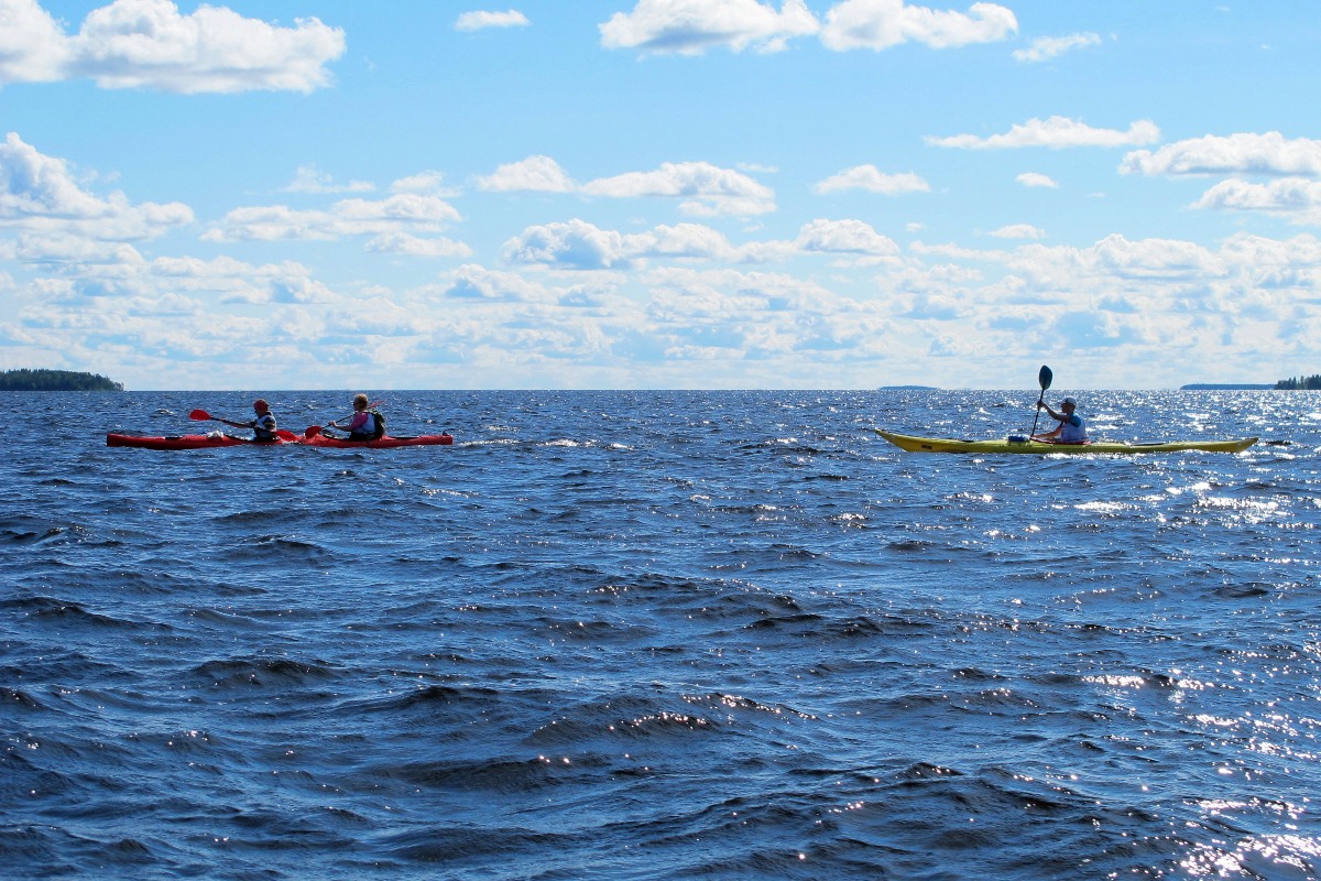
The water surface area of Lake Oulujärvi has doubled in the last 10,000 years as a consequence of tilting that has happened in conjunction with rising of the land. It is the fourth or fifth largest of Finland’s 180,000 lakes. The shores of the lake vary from steep, rocky slopes to long, sandy beaches. Overall, including the islands, there are around 920 kilometres of shoreline.
Lake Oulujärvi has Finland’s largest continuous open lake areas, the Niskanselkä and the Ärjänselkä. Between them lies the island of Manamansalo, which with its surface area of around 75 km2 is Finland’s fifth largest inland water island. The island has a shoreline of around 80 km, mostlysandy beaches. The island has more than 30 kettle hole ponds, steep sandy slopes and lichen heaths shaped by the Ice Age.
The overall look of the lakescape is continually changing according to weather conditions and the passing of the seasons. The scenery is austere, often consisting of only two elements, the open lake waters and the sky. In winter, on the icy expanse of the lake one can still sense heritage of the Ice Age.
In addition to eskers and dunes, the area’s particular natural forms include deep, clear lakes and kettle holes, of which one is the deepest in Finland. In the area is located the Rokua National Park, which was founded in 1956 to protect the area’s sensitive barren heaths.
The Rokua forests are low in nutrients and, due to the highly permeable soil, monotonous in terms of its flora. Characteristic of the pine‐dominated landscape are the white, treeless lichen heaths of the sand dunes. The very limited flora of the barren, dry heaths consists mainly of shoots. In winter, the treecovered hills keep the snow longer than the surrounding lower land. Accordingly, the snow covered terrain is also most effective in withstanding human activity.
The River Oulujoki Valley is a nationally valuable landscape area. In addition to the river, it is characterised by long‐standing agricultural activity. The River Oulujoki has been harnessed for electricity production; seven hydro‐electric power plants were built on the river in 1940s and 1950s. To the north of the river there are wooded ridge areas, and in the south open hillocks, mounds, forest groves and a field landscape cut by deep stream channels. In the river valley one can find southern, even demanding plants, because it is a transition zone between southern and northern plant species. The River Oulujoki Valley landscape is characterised by agriculture.
The water surface area of Lake Oulujärvi has doubled in the last 10,000 years as a consequence of tilting that has happened in conjunction with rising of the land. It is the fourth or fifth largest of Finland’s 180,000 lakes. The shores of the lake vary from steep, rocky slopes to long, sandy beaches. Overall, including the islands, there are around 920 kilometres of shoreline.
Lake Oulujärvi has Finland’s largest continuous open lake areas, the Niskanselkä and the Ärjänselkä. Between them lies the island of Manamansalo, which with its surface area of around 75 km2 is Finland’s fifth largest inland water island. The island has a shoreline of around 80 km, mostlysandy beaches. The island has more than 30 kettle hole ponds, steep sandy slopes and lichen heaths shaped by the Ice Age.
The overall look of the lakescape is continually changing according to weather conditions and the passing of the seasons. The scenery is austere, often consisting of only two elements, the open lake waters and the sky. In winter, on the icy expanse of the lake one can still sense heritage of the Ice Age.
In addition to the incomparable environment, the area tells the story of a prehistoric settlement of the human being and of theever since flourishing culture.
Rokua Geopark consists of the River Oulujoki Valley, Rokua esker and dune area and Lake Oulujärvi areas. The areas are linked by the Rokua esker field and its geosites, which were formed on top of ancient bedrock in the withdrawal phase of the last Ice Age (Weichsel).
The Rokua esker field, which originated from the Muhos Formation located in the River Oulujoki Valley, runs across the area from River Oulujoki valley to Rokua esker and dune area, through Lake Oulujärvi to Manamansalo. In addition to the geology, the areas are also connected by the prehistory of the people who followed the withdrawal of the ice sheet and sea.
Attractions:
In addition to eskers and dunes, the area’s particular natural forms include deep, clear lakes and kettle holes, of which one is the deepest in Finland. In the area is located the Rokua National Park, which was founded in 1956 to protect the area’s sensitive barren heaths.
The Rokua forests are low in nutrients and, due to the highly permeable soil, monotonous in terms of its flora. Characteristic of the pine‐dominated landscape are the white, treeless lichen heaths of the sand dunes. The very limited flora of the barren, dry heaths consists mainly of shoots. In winter, the treecovered hills keep the snow longer than the surrounding lower land. Accordingly, the snow covered terrain is also most effective in withstanding human activity.
The River Oulujoki Valley is a nationally valuable landscape area. In addition to the river, it is characterised by long‐standing agricultural activity. The River Oulujoki has been harnessed for electricity production; seven hydro‐electric power plants were built on the river in 1940s and 1950s. To the north of the river there are wooded ridge areas, and in the south open hillocks, mounds, forest groves and a field landscape cut by deep stream channels. In the river valley one can find southern, even demanding plants, because it is a transition zone between southern and northern plant species. The River Oulujoki Valley landscape is characterised by agriculture.
The water surface area of Lake Oulujärvi has doubled in the last 10,000 years as a consequence of tilting that has happened in conjunction with rising of the land. It is the fourth or fifth largest of Finland’s 180,000 lakes. The shores of the lake vary from steep, rocky slopes to long, sandy beaches. Overall, including the islands, there are around 920 kilometres of shoreline.
Lake Oulujärvi has Finland’s largest continuous open lake areas, the Niskanselkä and the Ärjänselkä. Between them lies the island of Manamansalo, which with its surface area of around 75 km2 is Finland’s fifth largest inland water island. The island has a shoreline of around 80 km, mostlysandy beaches. The island has more than 30 kettle hole ponds, steep sandy slopes and lichen heaths shaped by the Ice Age.
The overall look of the lakescape is continually changing according to weather conditions and the passing of the seasons. The scenery is austere, often consisting of only two elements, the open lake waters and the sky. In winter, on the icy expanse of the lake one can still sense heritage of the Ice Age.