

Contact Us
NO.26 BAIWANZHUANG ROAD,Beijing,100037.China
Tel: 86-10-68999619
86-10-68999623
Fax: 86-10-68310894
E-mail:
cgn@cags.ac.cn
ggn2004@gmail.com
%c_location% Home > Members list
Alxa Desert Geopark
Major Geoheritage and Their Significance
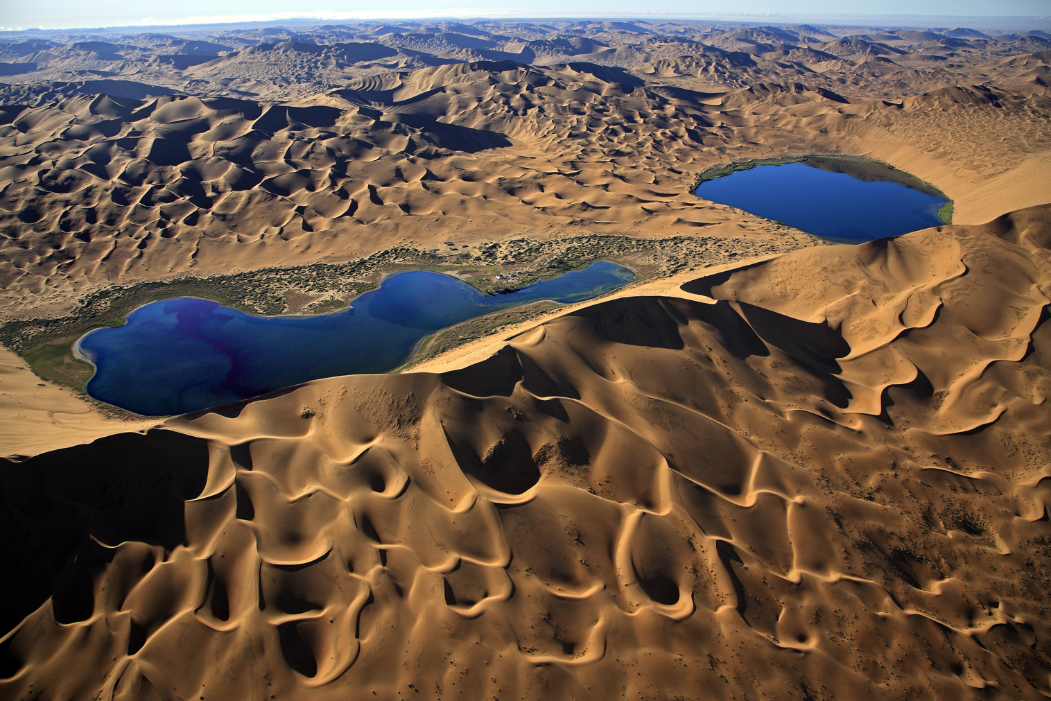
Badain Jaran Desert and Lakes in Oases The Badain Jaran Desert, the second largest desert in China, is located at the converging site of the western, northwestern and eastern sand areas, covering an area of about 4.32×10⁴ km2. This desert owns the highest sand hills and largest sounding sand area in the world. There are more than 140 lakes in the desert, supplied with an ancient culture and charmed Mongolian customs. The Badain Jaran Desert is of great significance in studying the desert formation, development and environmental change in the northwestern China. In addition, the charming desert landscapes in the desert have great tourist and aesthetic value for visitors and explorers.
Tengger Desert and Lakes in Oases The Tengger Desert, the fourth largest desert in China, covers an area of 4.27×10⁴km2. It is famed by numerous freshwater lakes (422 lakes in different sizes) and oases, with very good water sources. It is the desert with the maximal number of freshwater lakes in China. The lake scenery in the Tengger Desert is charming, with very good conditions to be tourist destination. The active sand dunes are separated by the fixed and semi-fixed sandy lands, lake basins and residual hills, so the desert is easy to be treated. Now, some lake basins have become the desert-treating bases.
Ulan Buh Desert The Ulan Buh Desert is located in the northeastern part of Alxa Zuoqi, covering an area of 0.99 ×10⁴km2. The active sand dunes are mainly distributed in the south and central sections, composed of crescent dune chain, grid crescent dunes and crescent sand hills, generally about 10~30 m high, and 50~100 m high in central areas. The Ulan Buh Desert has now become the typical demonstration area for the desert-treating engineering project in Alxa.
Ejin Gobi Landform The Gobi landform is mainly distributed in the central part of Ejin Qi, especially in the areas east to Mazong Mountain and west to Ejin River. The gravel layer of the Gobi is up to 700~800 m thick. The black Gobi around Mazong Mountain is very typical, where is an ideal place to study the Gobi formation, development and evolution. In addition,there are a lot of rare precious stones in the Ejin Gobi area, which are famous in China, with very high aesthetic value.
Juyanhai Lake The Juyanhai Lake is located in Ejin Qi, which is a terminal branch on the Heihe River, the second largest inland river in China. This lake was formed from the Early Mesozoic to Late Pleistocene, there were once three lakes:the East and West Juyanhai Lakes and Juyanze Lake. The Juyanhai Lake was once dried up in 1950~1960. Through the effective eco-environmental protection, the Juyanhai Lake is not only important in protecting the oases in Ejin, but also in raising awareness for the harmonious development between mankind and nature.
Tonghu Lake Area The Tonghu Lake area is composed a several small lakes in the Tengger Desert, which maintains a unique grassland wetland.
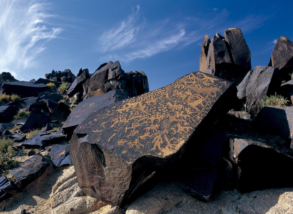
In the ancient time, the Tonghu Lake area was a vast unified lake. Due to the climatic shift and rainfall decrease, the lake area was slowly shrunken, now, it has become a small inland lake basin, composed of more than ten small lakes, the wetland owns a lot of wild plants and animals. The Tonghu grassland is surrounded by sand dunes, so this area owns desert, salty lakes, wetland, sand springs, oases, herd villages and rock paintings, it has reputed as an Eden in desert by domestic and foreign visitors.
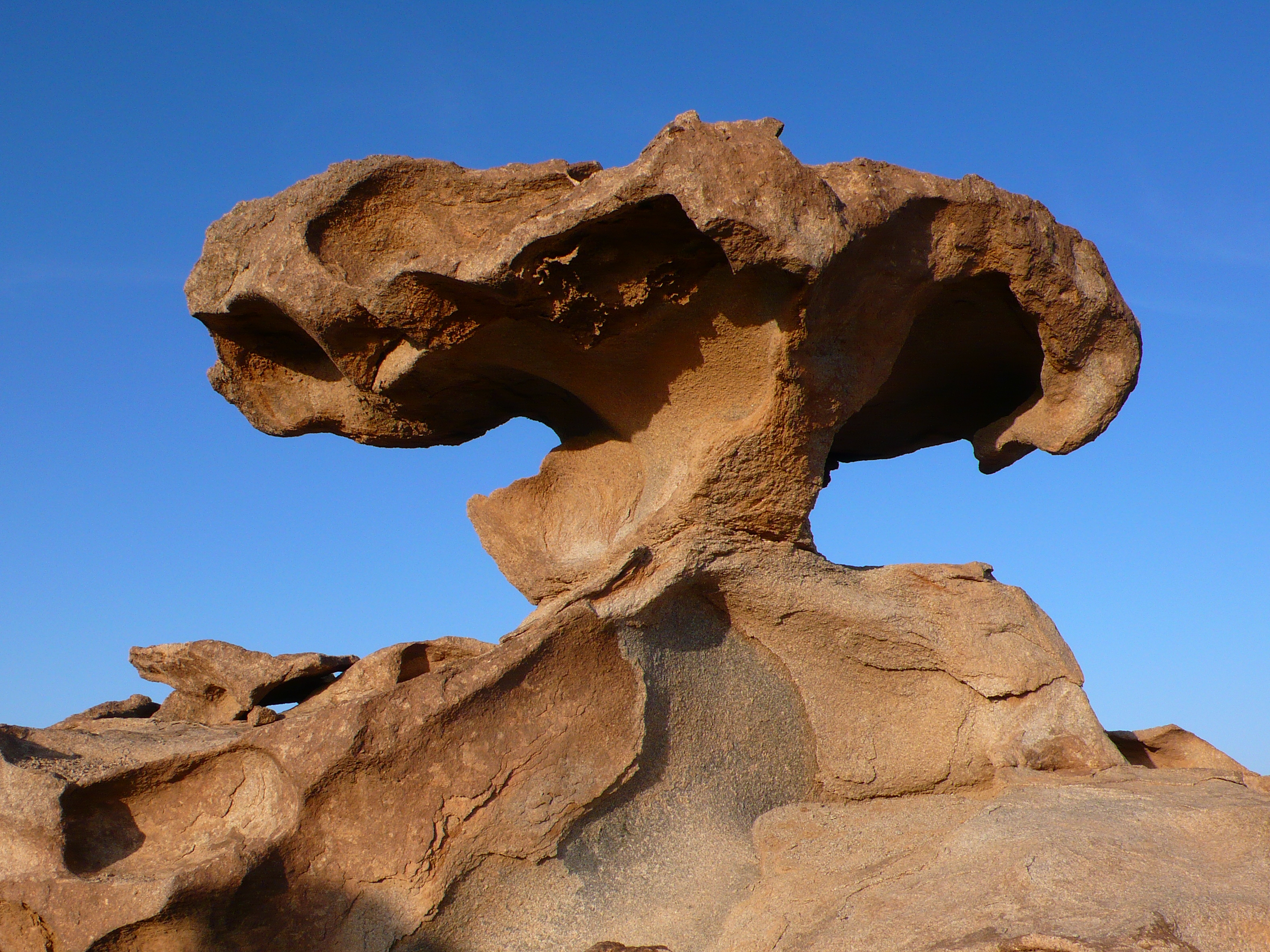
Haisenchulu Wind-eroded Landform Haisenchulu is situated in the northwestern part of Alxa Youqi, it is one of the developed wind-eroded landform areas in China. Within an area of several ten square kilometers, the wind-eroded granite landforms are large in scale, beautiful in shape and typical in landform. The mother rock is the Jurassic diorite granite, formed about 150~180 Ma ago, its surrounding rocks are the Ordovician-Silurian clastic rocks about 400-500 Ma ago. This area is at the inland arid zone in the northwest China, the arid and windy climate provide good conditions for forming such wind-eroded landform.
Eribugai and Aolunbylage Canyon Landform The canyon landform is mainly distributed in the Aolunbylage canyon group in Alxa Zuoqi and Eribugai canyon group in Alxa Youqi. These canyon landforms were suffered from the earlier flowing water erosion and later wind erosion. The canyon walls are steep, several ten meters high, with many tafoni, mushroom-shaped stones and others.
Email:
363798185@qq.com, Smgy2005@163.com