Rondane Geopark has spectacular glacial deposits that are fascinating to the specialist. In order to reach the wider public, "wide screen" photographs have been created by Bjørn Follestad and exhibited at the National Park Museum at Folldal.
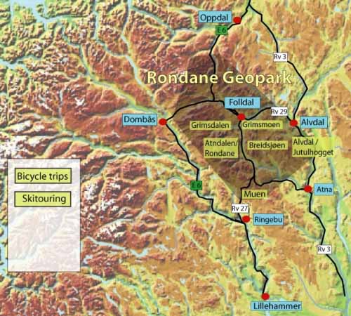
Rondane Geopark:
Norwegians have been inspired by Rondane for centuries - in visual art, music, literature and research. This is the place the composer Edvard Grieg found the inspiration for some of his well-known romantic-nationalistic compositions. Other artists, such as the painter Harald Sohlberg, captured the uniqueness of the landscape and the blue light, so characteristic for Rondane.
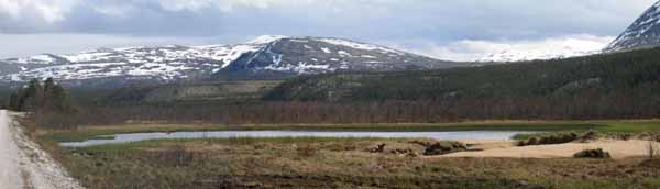
When the Ice Age released its grip on Norway 10.000 years ago, it left numerous marks in the landscape. These make it possible for us to explain how the landscape was shaped. The interaction of nature, art and culture makes Rondane one of the finest destinations when it comes to theme-oriented tourism - geotourism.
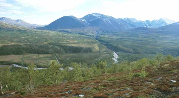
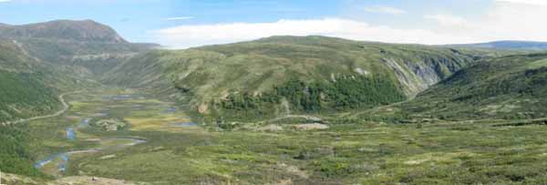
Our country has a long geological history of crustal folding into mountain ranges succeeded by erosion of the mountains. Even though the origin of the mountains is often as old as several hundred million years, the land formations are young in a geological sense. The approximately 50 million years old mountain massifs of Høgronden and Rondslottet represent the oldest formations. At that time Rondane was close to the equator. The mountain plateaus of today are situated at about 1100-1200 metres above sea level, which was the sea level at that time. The continental plates drifting to the north, as well as the crustal folding, caused renewed erosion by the rivers at that time. Great valleys, such as Østerdalen and Gudbrandsdalen, as well as their adjoining valleys, were shaped by river erosion before the ice ages started two million years ago. During the ice ages the mountain tops in these areas where sculptured by bottom glaciers. This has given Rondane several “botns” (circular valley formations in the mountain sides). In spite of glacial erosion it is the course of the old river valleys that characterizes the valleys in the landscape.
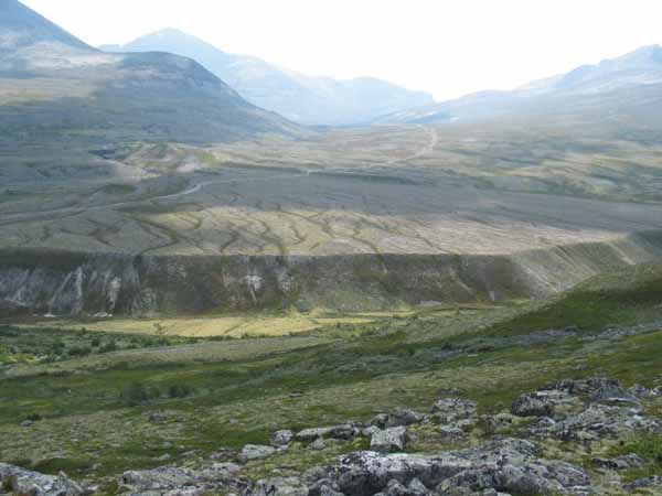
Ice movement to the northeast and north shows that the highest point of the inland ice was to the west and south of Rondane. Because of this, the glaciofluvial water ran north, on-top of, through and under the inland ice at the end of the Ice Age. Characteristic features such as drainage channels and terrasses formed along the ice margins. Large deposits of different kinds of debris were deposited by the inland ice. It is these deposits, together with the drainage channels, that give us the unique nature environment we can see in Rondane today.
All this, together with culture-historical impressions, is on display and can be experienced in the Rondane Geopark.