“The region that was ‘fire-born’”
Celebrating Earth Heritage
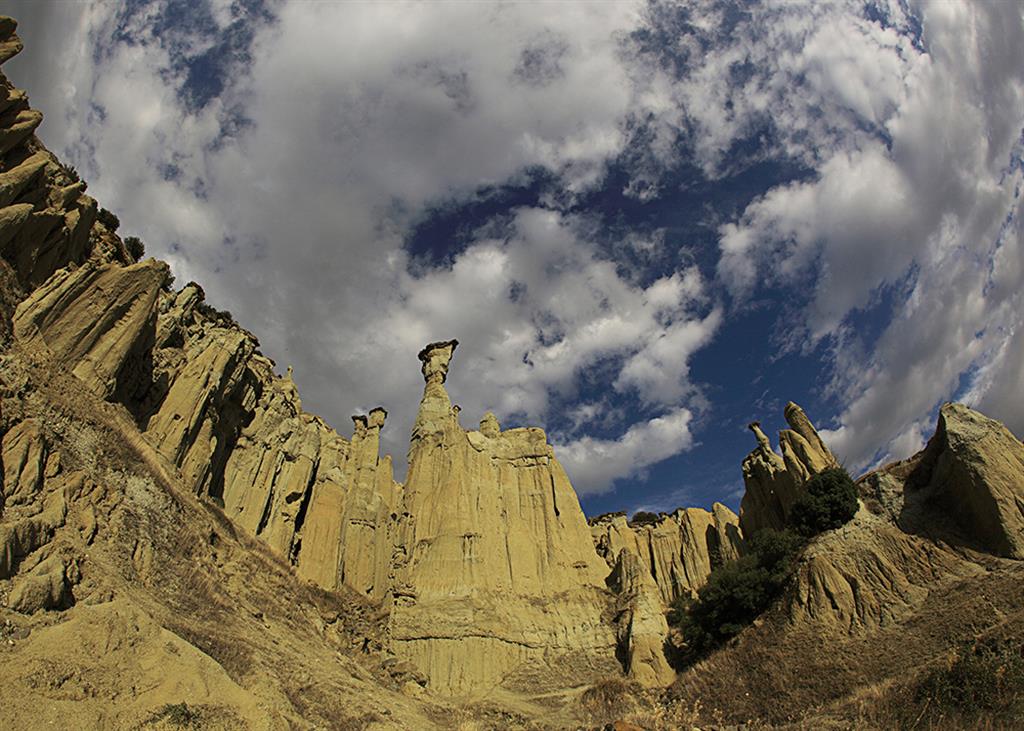
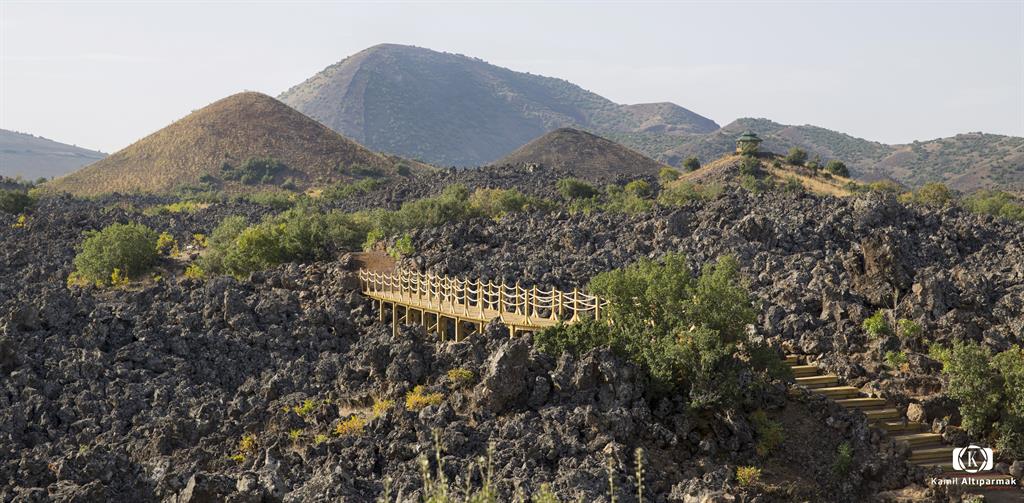
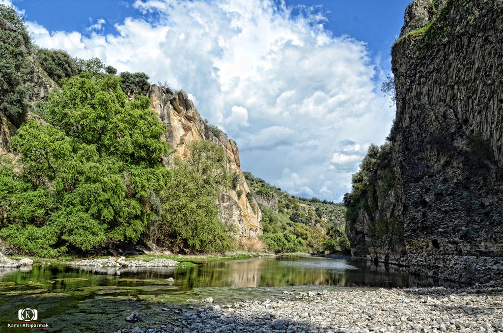
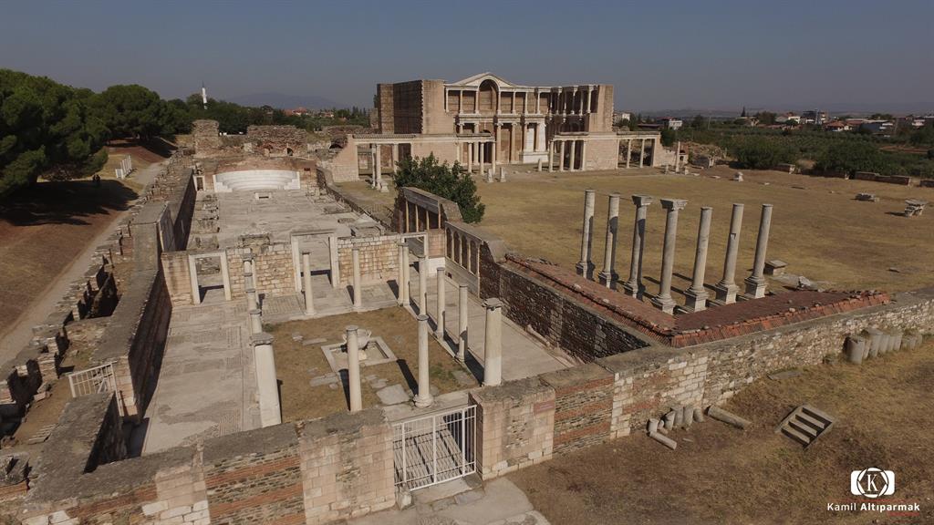
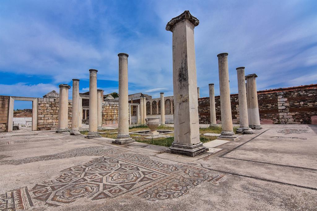
Located in the eastern part of the Aegean Region of Turkey, the UNESCO Global Geopark contains evidence from more than 200 million years of earth history, from Paleozoic metamorphic rocks to prehistoric volcanic eruptions. It encompasses three distinct areas: the Kula volcanic province: one of the youngest volcanic fields in Turkey, the Gediz Graben: a very tectonically active region and the Bozdağ Mountains. The Geopark features a large lava plateau, lava caves and basalt columns together with the range of morphological features associated with the formation of a graben, such as faults, fan deposits, earthquake related features, etc. The Geopark is also of great historical significance with Homoerectus Valley, the Çakallar human footprint fossils, the Kanlıkaya rock paintings and the tumulus tombs of what once was the capital of the kingdom of Lydia, where money is believed to have been invented, the ruins of Sardis, founded nearly 3,000 years ago, and of a temple dedicated to Artemis in the 3rd century BCE.
The area starts from 200 m above sea level in Salihli Town and rises up to 600 m mean elevation in Kula Town. Kula has a Mesothermal climate with hot dry summer and cold, rainy winters with rare snow.
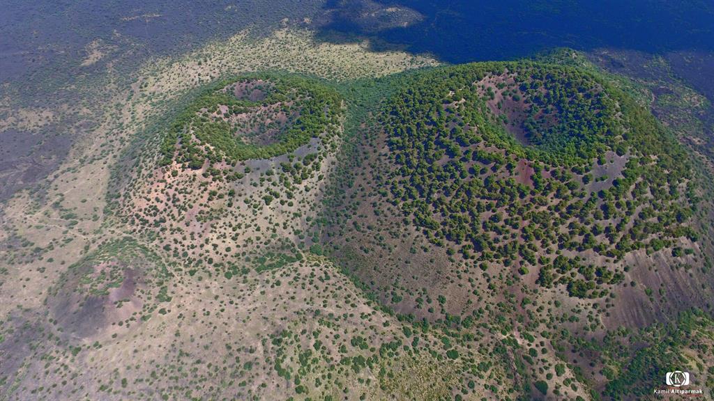
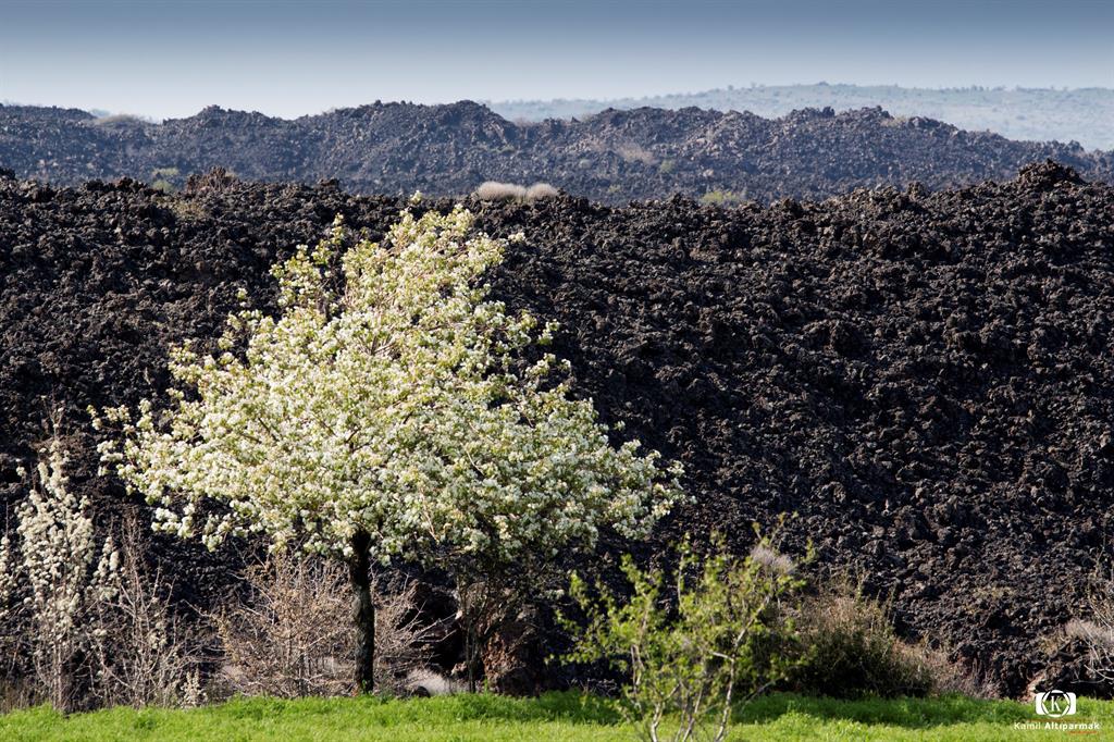
Kula-Salihli UNESCO Global Geopark has a complex geology due to the active tectonic regime in the Aegean extensional province, which is one of the most seismically active and rapidly deforming regions in the world dominated by converging plates, subduction collision related geodynamic process. Kula-Salihli UNESCO Global Geopark rests on the metamorphic basement of the Menderes massif and the ophiolitic mélange units of the İzmir-Ankara Zone, a remnant of the Tethyan Ocean. Kula is the youngest volcanic region in Turkey. The Quaternary volcanism in the area formed in three eruptive phases (1.1 million years to 300.000 and 15.000 years ago). The outstanding volcanic structures of the UNESCO Global Geopark area are well known since antique times where the great ancient Greek Geographer Strabo (63 BC-24 AD) in his majestic book “Geographica” named Kula as “KATAKEKAUMENE” (fire-born) because of the coal-black lava.
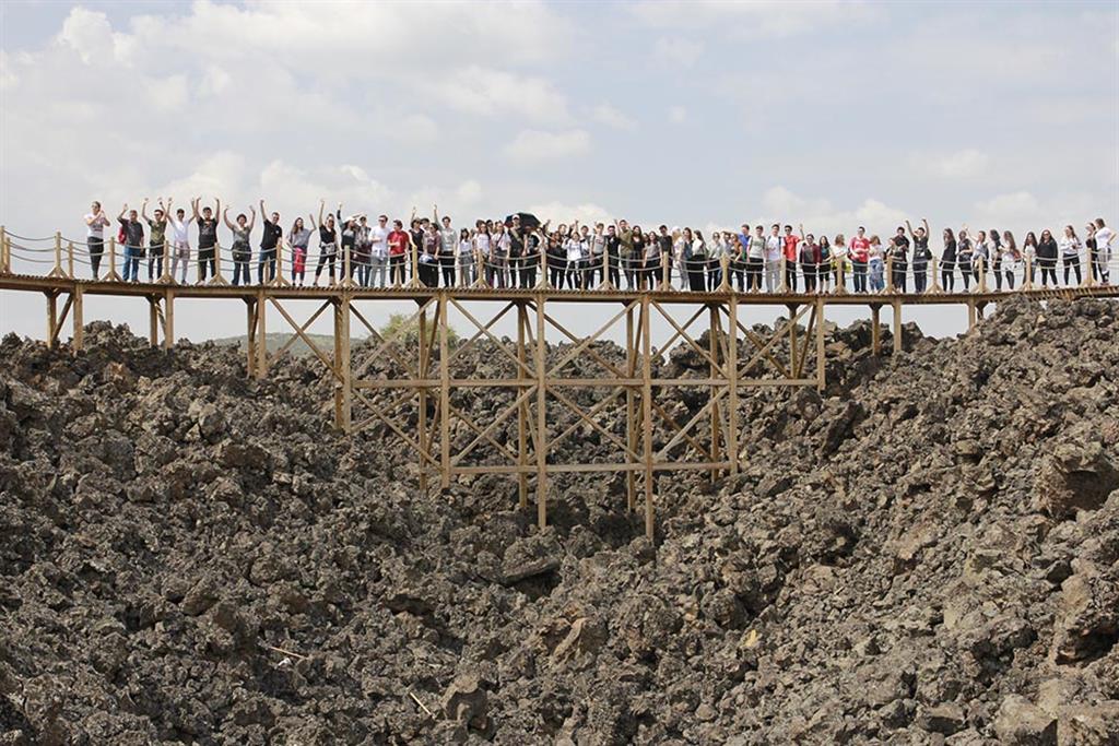
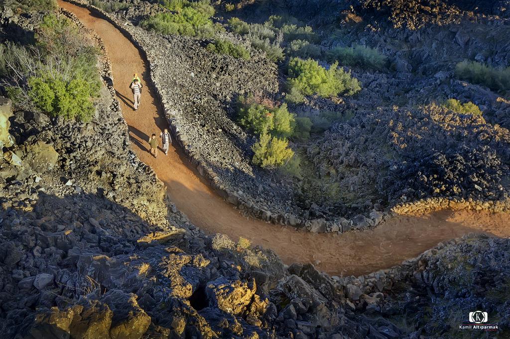
Kula-Salihli UNESCO Global Geopark has established a range of facilities and supply services in terms of geotourism and geo-education infrastructure. “Kula Geopark Visitor Centre KATAKEAUMENE” serves as information centre for tourists and as a Natural History Museum for Geo-education activities. It has a bilingual website and leaflets, and more than 12 km of well-organized geotrails connecting the most outstanding geosites, equipped with information panels. It offers guided tours for tourists, indoor and outdoor geo-education activities for school classes. In order to enhance these services and promote scientific research, “JARUM-Geopark Research Centre” was established in collaboration with the Celal Bayar University and the “JPBB-Geopark Municipal Union” and to finance the UNESCO Global Geopark based sustainable local development activities. The UNESCO Global Geopark founded the “GeoCycle” a bicycle society to combine sportive activity with geotourism.