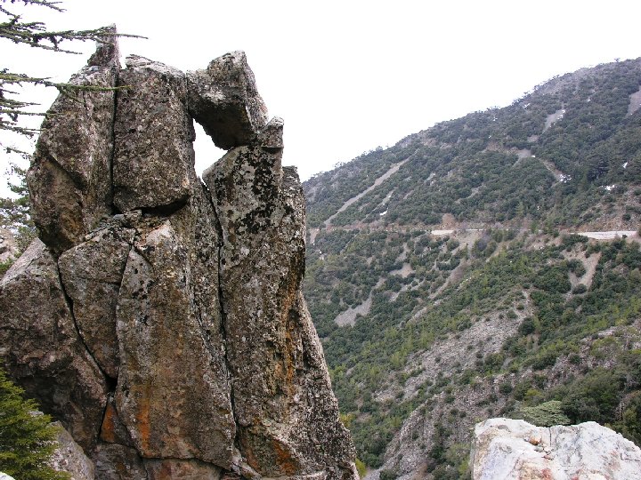
“Oceanic whispers on high altitude”
The mountainous Troodos UNESCO Global Geopark area is in the central part of the island with its highest peak, Olympos, at 1952 m and 57 km from the capital, Lefkosia. It has an area of 1.147 km2 and its boundary is roughly delineated by the extent of the ophiolite complex. The mountains are covered by natural forests and agricultural fields, vineyards and orchards. The uplift of the ophiolite fragmented its rocks, with radial drainage patterns creating varied and impressive landscapes.
The Troodos ophiolite is internationally known amongst geoscientists for its stratigraphic completeness and well-preserved and well-exposed plutonic, intrusive, volcanic rocks and chemical sediments. Formed 92 million years ago in the Neotethys Ocean by seafloor spreading above a subduction zone, it was uplifted and placed in a dome structure by the collision between the Eurasian and African plates. Asbestos and umber were exploited since antiquity but it was the production and trade of copper from the Cyprus-type massive sulphide deposits that made Cyprus synonymous with copper. The asbestos mine in the serpentinite, now rehabilitated, the chromite mining galleries in the dunite, the ancient copper slag heaps around the copper mines in the pillow lavas, extensive parallel dyke landscapes, spreading center graben valleys and a fossilized transform fault constitute an important geodiversity with significant contributions to the development of plate tectonic and ocean spreading theories as we know it today.
It includes 110 municipalities with a population of 25.000 falling in four districts, Lefkosia, Larnaka, Lemesos and Pafos. It is easily accessible by short scenic routes from the three biggest cities that meet in Troodos square but also an excellent network of country roads through the 110 traditional villages.
The UNESCO Global Geopark goes hand-in-hand with Government policies for the sustainable development of the Troodos mountains area. The self-sustained Geopark Centre, located in an early 20th century renovated school of the rehabilitated Amiantos mine, is the main education center with geological and mining exhibits, a lecture room and a store. It uses a demonstration kit and a documentary during school visits. Many foreign universities conduct field schools in the ophiolite. The nearby Botanical Gardens, the Environmental Information Centre in the Troodos square and the Environmental Education Centre in Pedoulas village receive thousands of children and visitors every year. The local community, represented by the Troodos District Development Agency, also serves as operator of the Center. Local festivals, taverns, wineries, traditional workshops, geological and nature trails, waterfalls, museums, monasteries, medieval bridges and ten UNESCO World Heritage Byzantine churches complete the picture for a demanding geotourist.


